
Introduction
Topographic map
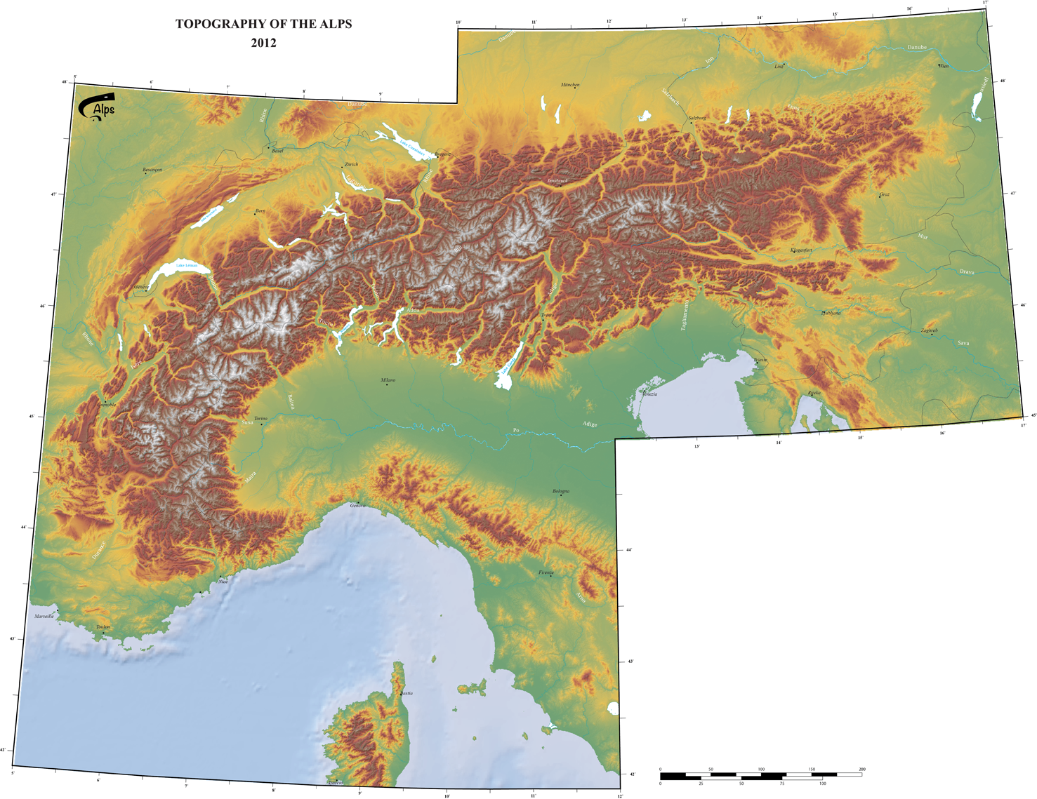
click on the picture for more details or to zoom
Map
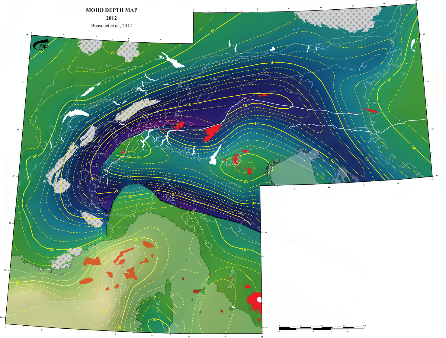
click on the picture for more details or to zoom
Paleogeography
 |
 |
 |
 |
 |
References
To cite documents from this pageRobert C., Wiederkehr M., Rossi Ph., 2012, Tectonic framework of the Alps, CCGM/CGMW. http://www.geodynalps.org
All documents are licensed under Creative Common terms. They can be downloaded and used without limitations, except commercial purpose without permissions. If you use for publication some documents, modified or not, you have to cite them and to share them for free.

This work by GeodynAlps / R. Bousquet is licensed under a Creative Commons Attribution-NonCommercial-ShareAlike 3.0 Unported License.