
Tectono-metamorphic age map of the Alps
There are different opinions about the age and paleogeographic position of some units (e.g. Cretaceous vs. Paleogene, number of subduction sites, age of the collision; see for example Polino et al. 1990),which are partly due to conflicting determinations of the timing of metamorphism (e.g. Chopin & Maluski 1980; Hunziker et al. 1992; Gebauer 1999) and partly due to a fragmentary view of the Alpine belt.
We summarized the many age data onto map and profiles, in order to discuss the different building stages of the Alpine belt
The Map
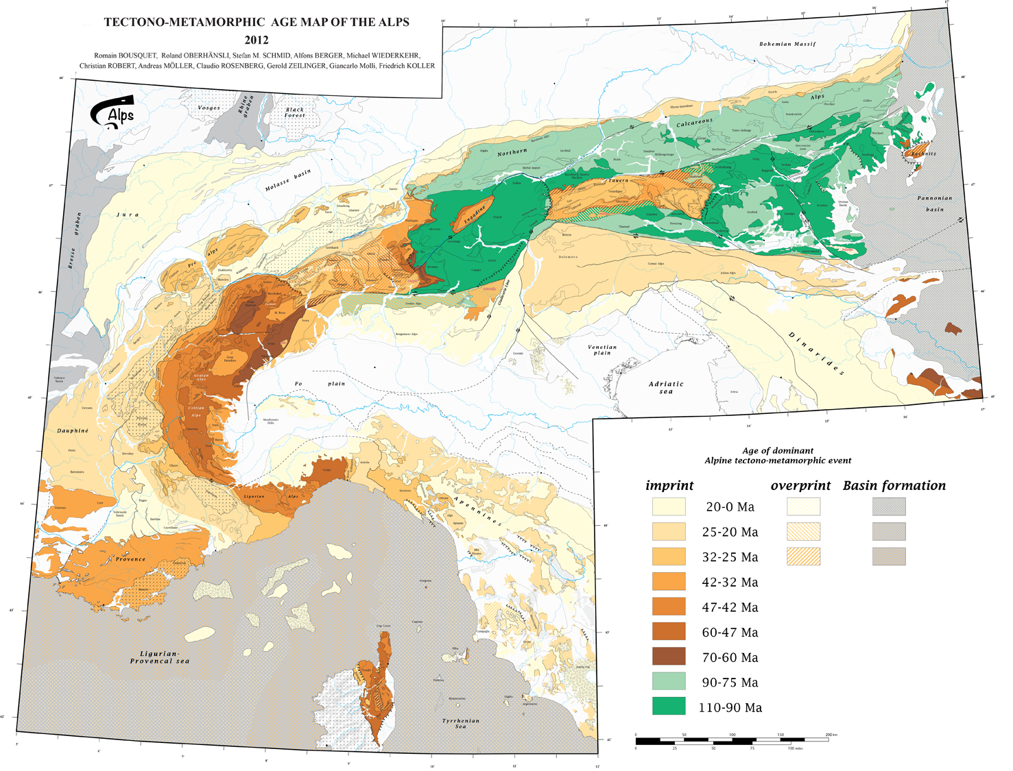
click on the picture for more details or to zoom
Profiles
 |
 |
||
 |
 |
 |
References
To cite documents from this page
All documents are licensed under Creative Common terms. They can be downloaded and used without limitations, except commercial purpose without permissions. If you use for publication some documents, modified or not, you have to cite them and to share them for free.

This work by GeodynAlps / R. Bousquet is licensed under a Creative Commons Attribution-NonCommercial-ShareAlike 3.0 Unported License.